
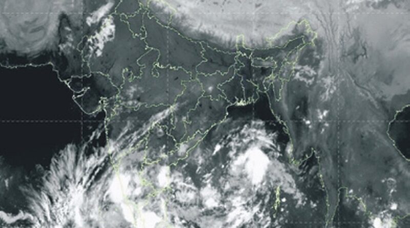
Odisha: All weather models flag cyclone in Bay of Bengal next week
BHUBANESWAR: The Bay of Bengal could witness its first cyclonic storm of the season, with multiple weather models indicating the formation of an intense weather system and its possible movement towards India’s eastern coast next week.
Weather models such as ECMWF, ECAI and NCEP GFS indicate that the system could intensify into a very severe cyclonic storm, while AI-based models such as Mithuna and IMD FGN and FCN project it to develop into a cyclonic storm.There is consensus among various models on the area where the system is likely to form. A low-pressure area could develop around Saturday, followed by rapid intensification into a depression. Models such as Mithuna and IMD GFS, however, suggest that the system may develop into a depression only around October 27 or 28. There is no consensus among the models on its likely intensity.
Despite the uncertainty over its intensity and track, national and international weather trackers suggest that the system, emerging from the vicinity of the Andaman Islands, could develop into a powerful storm and move towards the Andhra Pradesh coast. Some also indicate a impact on southern and coastal Odisha.
In its bulletin on Thursday, the India Meteorological Department (IMD) said an upper-air cyclonic circulation over the southeast and adjoining east-central Bay of Bengal and the Andaman Islands was likely to develop into a low-pressure area. The system is then likely to move west-northwestwards and intensify into a depression by Sunday morning.The IMD has forecast heavy rainfall, strong winds and rough sea conditions in parts of Odisha next week. Heavy rainfall is likely at one or two places in Balasore, Keonjhar, Mayurbhanj, Rayagada, Koraput, Gajapati, Ganjam and Puri districts on October 27.
Similar weather conditions are likely at isolated places in Balasore, Keonjhar, Mayurbhanj, Nabarangpur, Rayagada, Koraput, Malkangiri, Gajapati, Ganjam, Puri, Khurda and Nayagarh districts on October 28.
The IMD also said the system was likely to trigger gale winds of 70-80 kmph, gusting to 90 kmph, over the west-central and adjoining east-central Bay of Bengal from
The system may continue moving west-northwestwards and strengthen over the next three days. Given the warm sea surface temperatures and other favourable meteorological conditions, this system has the